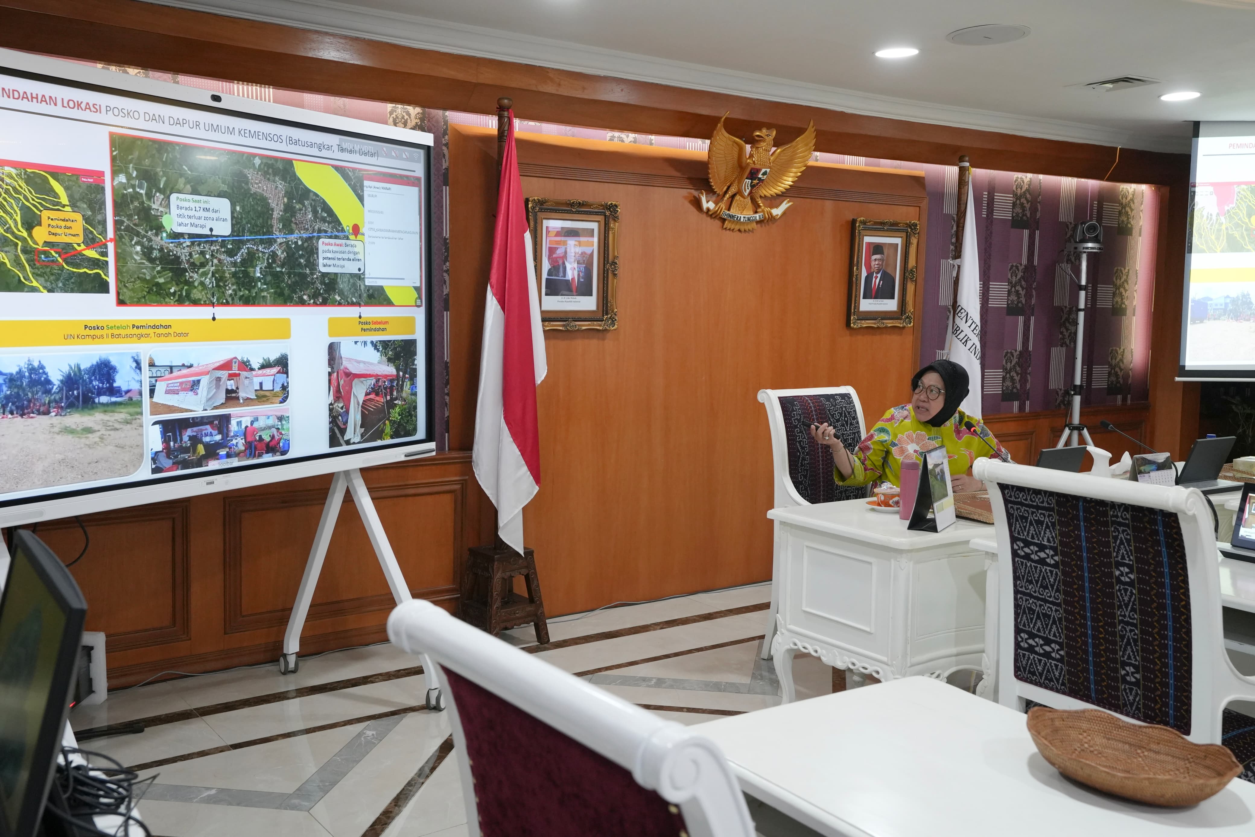
JAKARTA (May 17, 2024) - Minister of Social Affairs Tri Rismaharini combined the cold lava flow map of Mount Marapi with settlement conditions to obtain data on areas at risk of being affected by cold lava floods in West Sumatra. The lava flow map obtained from the Ministry of Energy and Mineral Resources (ESDM) shows locations at risk of being affected by lava flow in the event of rain upstream.
This map is also the basis for Social Affairs Minister Risma when moving the evacuation site coordinated by the Ministry of Social Affairs. Previously, the Ministry of Social Affairs post in Tanah Datar Regency was in an area that could be hit by cold lava flows. However, after Risma used geotagging and overlaying with the lava potential map, the post was immediately moved 1.7 km from the outermost point of Mt Marapi's lava flow zone.
According to Social Affairs Minister Risma, cold lava floods still have the potential to occur. She obtained this information from the officer of the Mount Marapi Monitoring Post of the Center for Volcanology and Geological Disaster Mitigation (PVMBG), who said that there are still many piles of post-eruption material in the caldera that have the potential to come down through lava flows. To anticipate the impact, Social Affairs Minister Risma will prepare evacuation camps at safe points for residents who live in the path of cold lava.
"The first thing to do is to prepare more evacuation centers to accommodate the possibility that they have been living in the lava flows, especially for the elderly, women, and children," said Minister Risma during a press conference session on cold lava flood disaster management at the Ministry of Social Affairs Office, Central Jakarta, Friday (5/17).
Furthermore, the Ministry of Social Affairs and related parties will establish a 24-hour post to provide information and help the community if there is a potential disaster. In addition, Social Affairs Minister Risma will prepare evacuation routes and dangerous route markers to minimize the impact of disasters.
Social Affairs Minister Risma said that the Ministry of Social Affairs will prepare a disaster map that can be accessed by the wider community and is equipped with a map of the location of social granaries. "I am preparing for this map to be accessed by the community so that people know their position with geotags and whether they are safe or not," said the minister.
 Bahasa
 English


